Eagle

Eureka Lab Drones

Autonomous Aerial Solutions for Defense, Surveillance & Humanitarian Response

WhatsApp Image 2025-04-06 at 14.50.02_2b183aec
EAGLE V1 - Coming Very Soon!

The sky isn’t the limit. It’s the workspace.

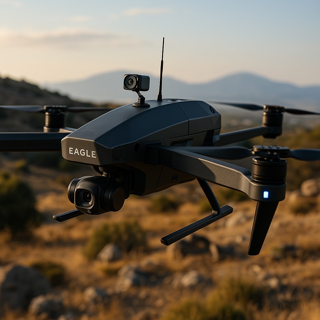
Eagle-1 is not just a drone—it's your field assistant from the sky. Engineered to tackle Bangladesh's unique geographical and infrastructural challenges, this is your new go-to tool for smarter surveying, safer inspections, and real-time decision making.

📅 Expected First Flight: 15th May, 2025

🦅 What Eagle-1 Can Do

  • Flies for up to 1 hour without needing to land
  • Covers 40 kilometers in one go—great for large areas.
  • Crystal-clear live video – See what the drone sees, smoothly and clearly.

  • Fly your way – Take full control, guide it partway, or let it fly itself.
  • Avoids obstacles automatically – Trees, poles, buildings? It dodges them smartly.
  • Always knows where it is – Dual GPS and onboard AI keep it on track.
  • Steady visuals, even in motion – Thanks to its built-in stabilizer.
  • Weather-ready & low maintenance – Built tough, runs smooth.


🚀 What Makes Eagle-1 Special

  • Designed and built in Bangladesh

  • Flies missions in under 20 minutes with rapid data return

  • Modular and repairable—no more downtime

  • Easy to operate—no pilot required

  • Ready for rivers, floods, farms, and research

With EAGLE V1, we bring tactical advantage and human safety to the same side of the mission.

WhatsApp Image 2025-04-06 at 14.50.02_65a55e4c
HGSRD-001 (Hybrid Glider)

Long-Endurance, Low-Impact Intelligence

Designed for silent, solar-powered surveillance, HGSRD-001 combines energy efficiency with mission precision. With its 6-ft wingspan and 7-hour flight time, it’s engineered to cover long-range zones while minimizing environmental footprint.

Key Capabilities:

  • Solar-powered with lithium-ion backup
  • Over 7 hours of flight time, 60 km operational range
  • Equipped with high-resolution camera, LIDAR, and thermal imaging
  • Capable of air quality monitoring and environmental scanning
  • Achieves 1 cm precision detection
  • AI-powered navigation and obstacle mapping
  • Radar-absorbing body designed for stealth operations

Designed For:

  • Border patrol & coastal surveillance
  • Humanitarian aid drop in remote zones
  • Disaster assessment (floods, cyclones, earthquakes)
  • Battlefield recon with zero engine noise
  • National defense modernization under
  • Forces Goal 2030
WhatsApp Image 2025-04-06 at 14.50.02_65a55e4c

Think of it as an aerial guardian — quiet, sharp, and always alert.

WhatsApp Image 2025-04-06 at 14.50.02_eb9ff570
GSR-001 (Glider Drone)

Efficient Recon for Tough Terrain

Designed for silent, solar-powered surveillance, HGSRD-001 combines energy efficiency with mission precision. With its 6-ft wingspan and 7-hour flight time, it’s engineered to cover long-range zones while minimizing environmental footprint.

GSR-001 (Glider Drone)

Efficient Recon for Tough Terrain

Designed for silent, solar-powered surveillance, HGSRD-001 combines energy efficiency with mission precision. With its 6-ft wingspan and 7-hour flight time, it’s engineered to cover long-range zones while minimizing environmental footprint.

Highlights:

  • Electric propulsion with solar assist
  • Thermal & optical zoom imaging
  • Encrypted real-time data link
  • Catapult launch, belly landing
  • Modular upgrades for multi-scenario roles
  • Air quality sensing & LIDAR-supported terrain mapping
WhatsApp Image 2025-04-06 at 14.50.02_eb9ff570

Mission-Ready For:

  • Reconnaissance in high-risk zones
  • Border activity monitoring
  • Ecological threat detection
  • Force training & simulation
  • Low-budget, high-output surveillance

Built by Engineers. Powered by Purpose.

Behind every drone is a team of innovators combining aerospace engineering, AI integration, and tactical vision:

  • Md Salauddin Sakib – Project Lead & Embedded Systems Specialist.
  • Matthews Ankon Baroi – AI Developer & Firmware Engineer.
  • Sheikh Rakib Shahriar Rimen – Strategic Planner & Market Lead.

Ready to Elevate National Security?

Whether you're from defense, research, or emergency services - our drones are designed to serve missions that matter.